Inicio » Soluciones y Servicios » Geophysical studies for the evaluation of geological hazards in urban areas.
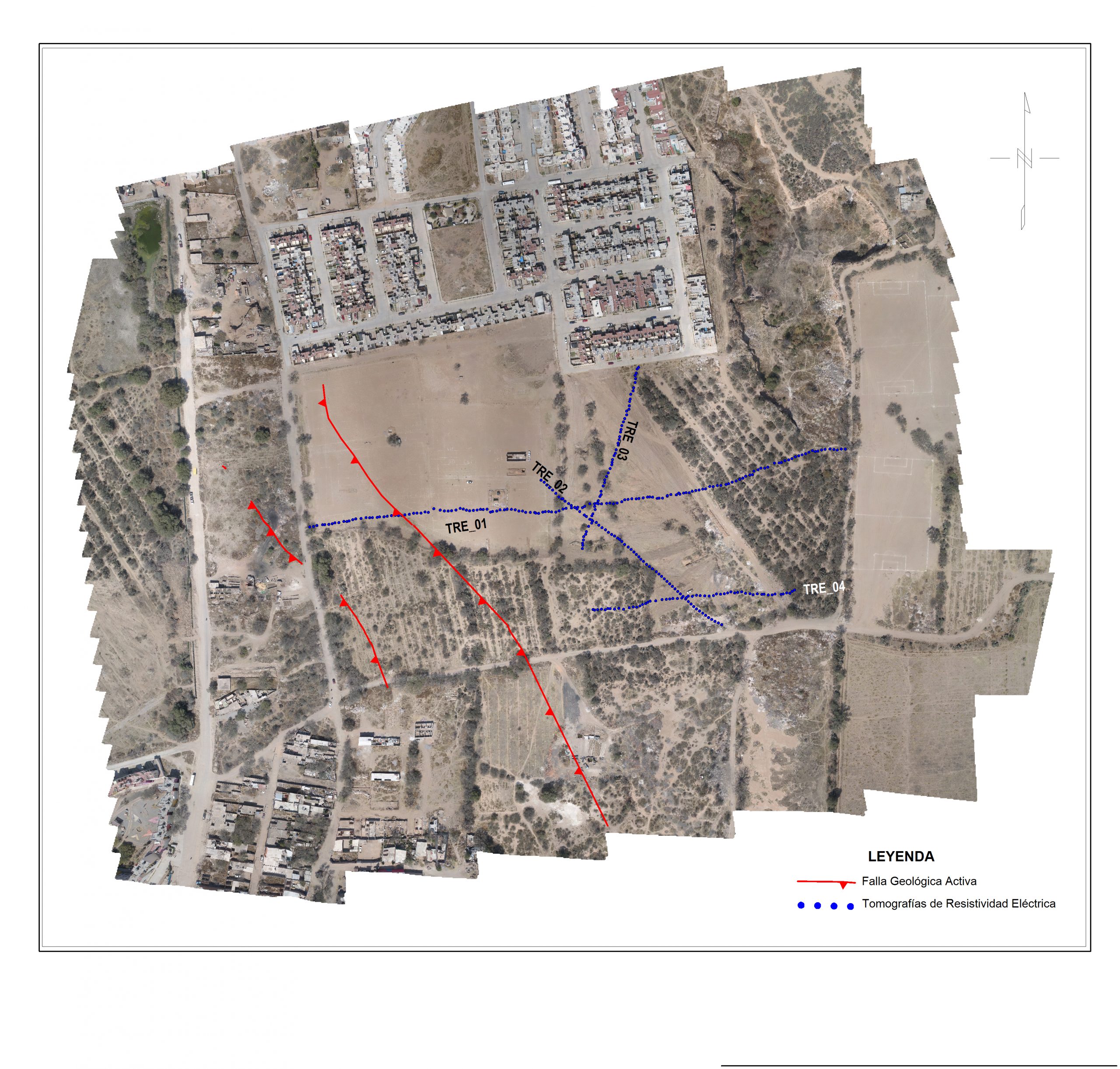
Characterize with geophysical techniques the active geological faults and cavities that represent a risk to the population, which may be present in avenues, highways, streets and subdivisions.
One of the main objectives is to determine the preferential course of the geological fault if it exists in the property (study area) and to rule out potential risk zones (fault branches), analyzing the subsoil with geological-geophysical techniques in future areas to be urbanized.
There are several geophysical techniques used in the analysis of geological risks, among which the following stand out:
Geo-radar: The georadar uses electromagnetic waves to map the subsurface. It is useful for identifying soil or rock layers, as well as subway structures such as faults or cavities. This technique can be valuable in assessing ground stability and the presence of potential geologic hazards.
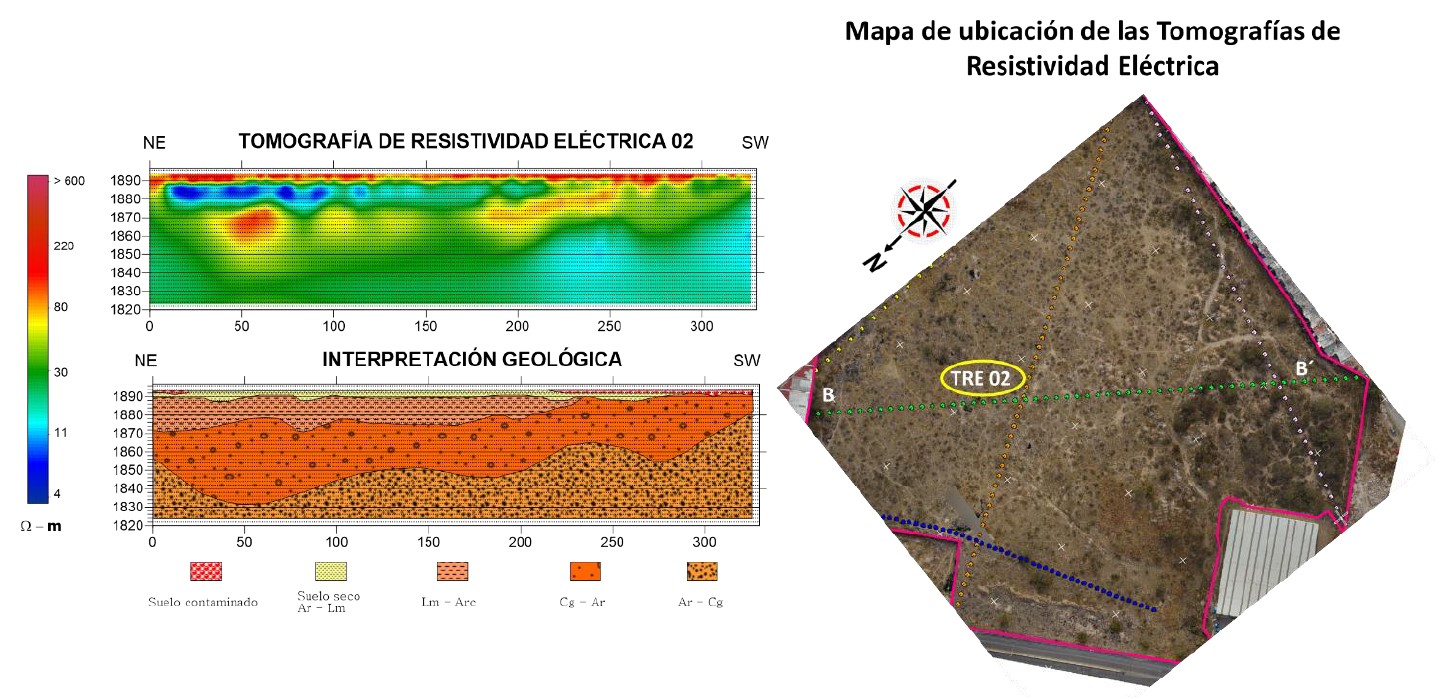
Geoelectrical prospecting: Electrical prospecting is based on the measurement of the electrical resistivity of the subsoil. It allows to identify the presence of water, changes in soil composition and the presence of fractures. This can be relevant to assess the risk of landslides and slope stability.
Gravimetry: Gravimetry is based on the measurement of the earth's gravity. Variations in gravity can indicate the presence of geological structures, such as mountains, sedimentary basins or volcanic intrusions. This can be useful in assessing landslide risk and slope stability.
Contáctanos y podemos ayudarte a encontrar la herramienta que mejor se adapte a tu proyecto,
All rights reserved
Camino a la Presa San José 2055. Col. Lomas 4 sección CP. 78216, San Luis Potosí S.L.P.
Tel: (444) 834 20 00 Ext 7327
ott@ipicyt.edu.mx

What is gob.mx?
It is the single portal for procedures, information and citizen participation. Read more