This hydrogeological study aims to identify optimal areas for water well drilling. Through a combination of geophysical techniques and geohydrological analysis, the most suitable location for sustainable groundwater extraction will be determined. The study will focus on assessing groundwater availability, quality and productivity in the areas of interest.
Methodology:
- Analysis of existing data: Previous hydrogeologic and geologic information available for the study area will be compiled and analyzed. This includes geologic maps, previous drilling data, well logs and other relevant data.
- Geophysical stidies.
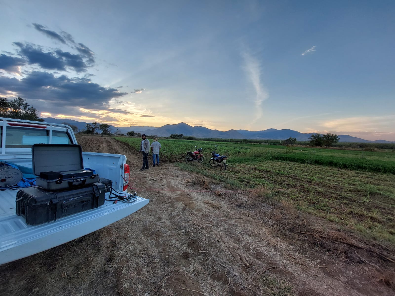
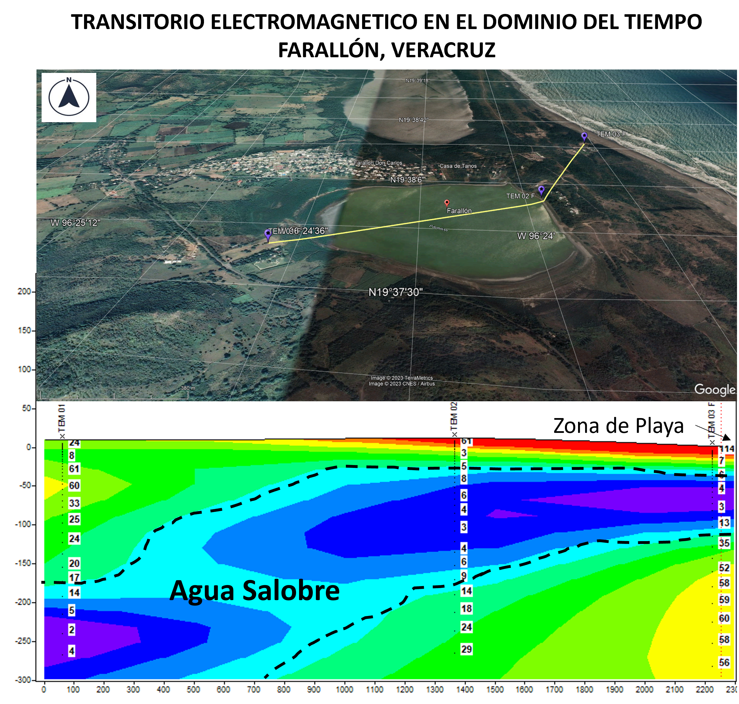
- La técnica de transitorios electromagnéticos (TEM) es una herramienta eficaz para investigar y caracterizar las aguas subterráneas. Estas técnicas se basan en la generación de campos electromagnéticos mediante pulsos eléctricos y la medición de la respuesta electromagnética del subsuelo alcanzando una profundidad de hasta 1000m. La resistividad eléctrica está relacionada con la presencia y calidad del agua subterránea, ya que los acuíferos suelen tener una resistividad menor que las formaciones rocosas impermeables. La variación de la resistividad eléctrica puede indicar la presencia de zonas con alta conductividad, que podrían corresponder a acuíferos, y zonas con baja conductividad, que podrían corresponder a formaciones rocosas impermeables.
- Electrical resistivity tomography (ERT) and vertical electrical sounding (VES) techniques. Vertical electrical sounding is based on Ohm's law which establishes the relationship between electric current, voltage and resistance. To perform a vertical electrical sounding, an electrode configuration is established in the ground. This involves placing a pair of current electrodes (A and B) and a pair of potential electrodes (M and N) in a straight line. The distance between the electrodes and the spacing between them are chosen according to the desired exploration depth. Water exploration with vertical electrical sounding is a widely used and effective technique for the identification and characterization of subway aquifers. It provides valuable information for water well location and design, water resource management and planning of water-related projects.
- Assessment of water availability and quality: Chemical and physical analyses of groundwater samples will be conducted to assess its quality and determine if it meets drinking water standards. In addition, groundwater availability will be assessed in terms of aquifer recharge and sustainable supply capacity.
- Water productivity analysis: Groundwater productivity will be evaluated in terms of aquifer permeability, transmissivity and other relevant hydrogeological characteristics. This will allow determining the capacity of the wells to supply an adequate flow of water in a sustainable manner.
- Identification of drilling areas: Based on the results obtained, the most promising areas for drilling water wells will be identified. These areas will be selected based on groundwater availability, quality and productivity, as well as geological and access considerations.
- Report and Recommendations: A detailed report will be submitted that will include the results of the study, recommended areas for well drilling, and relevant technical and environmental considerations. In addition, recommendations for the proper design and management of the wells to be drilled will be provided.
This hydrogeological study will provide key information for decision making regarding the location and design of groundwater wells, thus contributing to the sustainable management of water resources in the areas of interest.